
Burlington ZIP Code Coverage
The official NCDOR ZIP table identifies three ZIP codes with Burlington entries: 27215, 27216, and 27217. They are useful starting areas, not municipal boundary lines. The county recreation plan and health assessment give broad area descriptions, while the postal service decides the correct city, state, and ZIP for a specific delivery address. Use a parcel record or GIS map when the question is whether land lies in Burlington or in Alamance County.
| ZIP | Burlington-area coverage | Postal facility context | Record-search caution |
|---|---|---|---|
| 27215 | Core and southwestern Burlington, grouped locally with Alamance and Bellemont | Burlington Post Office, 405 Maple Ave | NCDOR also has a Guilford County row, so confirm the parcel county. |
| 27216 | Burlington mailing ZIP, grouped with southwestern Burlington | No dedicated facility or PO-box classification was verified | Do not infer city limits or delivery type from the ZIP alone. |
| 27217 | Northern Burlington, Glencoe, Glen Raven, Pleasant Grove, Green Level, and Anderson area | North Burlington facility on N Church St; another facility is on W Webb Ave | NCDOR also lists a Caswell County row for 27217. |
Other city-facing ZIPs were not verified in the official table. In particular, 27244 is listed for Elon, not Burlington. A correct ZIP can still have a mailing-city relationship that differs from the city or county that keeps the relevant record.
Burlington Postal Area Checks
The USPS postal lookup offers three useful paths. By Address requires a street address and permits apartment information. By City and State returns ZIP choices for a place name. Cities by ZIP begins with the five-digit ZIP. The result helps verify deliverability and the recommended mailing form, but USPS says it does not confirm that a particular person or company is at that address.
USPS postal lookup shows the address, city-and-state, and ZIP-based modes used to verify a Burlington postal code before a record search.
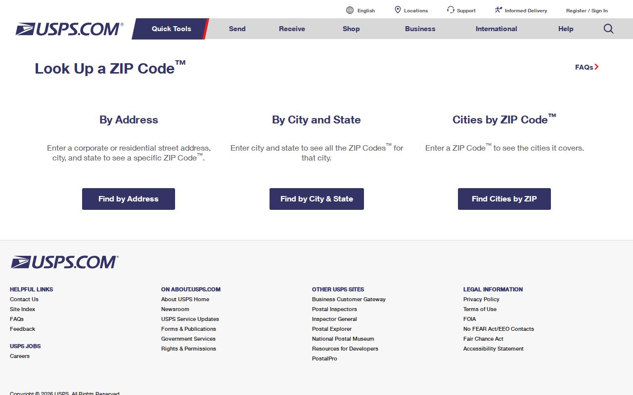
Use the postal result to normalize the address, including unit detail, before trying a county parcel or permit search. It resolves a delivery question, not a residency question.
| USPS field or mode | What the research captured |
|---|---|
| By Address | Company is optional; street address is required; apartment or suite is optional; city, state, and ZIP are supplied with a Find control. |
| By City and State | City and state are required. This mode helps compare a Burlington mailing name with possible ZIP choices. |
| Cities by ZIP | The five-digit ZIP is required. It is useful when a ZIP appears on an older note or a document. |
Burlington Postal County Crossings
Two entries make the boundary issue especially clear. The NCDOR table includes a Guilford County row for 27215 and a Caswell County row for 27217. That does not mean every address with either ZIP lies outside Alamance County. It means a five-digit postal area can cross county and city lines. For tax, deed, court, or election work, the county attached to the exact parcel is the controlling local jurisdiction.
Postal delivery and jurisdiction answer different questions. USPS validates an address for mail, while Alamance GIS and Tax records help establish the parcel location and record custodian.
For a current technical check, the USPS AIS Viewer reports five-digit ZIP, ZIP+4, carrier route, county code, and delivery-point verification. Its data updates monthly and it is not an export tool.
USPS AIS Viewer is the source for this Burlington postal address-quality view.
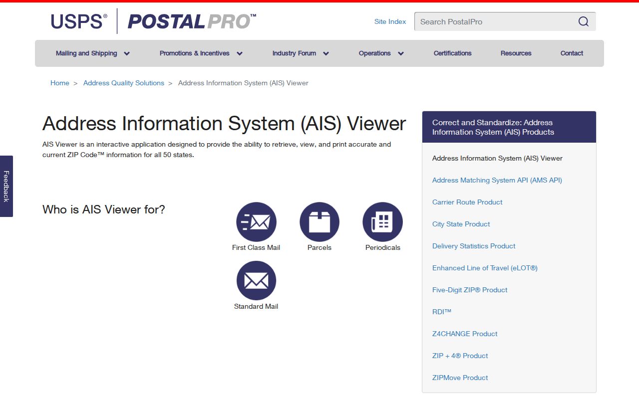
The viewer is most helpful when a postal answer conflicts with a map or a county field. Keep both results, then ask the appropriate custodian about a record mismatch.
Note: A Burlington mailing name is useful for delivery, but it cannot by itself establish municipal jurisdiction or the correct county records office.
Search Burlington Residents by ZIP Code
A ZIP can narrow an address trail, but Burlington’s local portals do not all expose a verified ZIP filter. USPS is the confirmed ZIP-first tool. Alamance Tax and the GIS viewer support address and parcel work, although the accessible research did not verify a ZIP search field in either interface. The state voter lookup has a county selector, not a ZIP field. A county file may contain released address fields, but a custom compilation is not guaranteed.
- Confirm the address and ZIP with USPS, including any apartment or suite information.
- Use the address in Alamance Tax or the Alamance GIS interactive map to identify the parcel and its jurisdiction.
- For voter information, search the person-centered NC Voter Search with name and status, or ask the elections office about a lawful public-record request for existing data.
- Use the parcel address, rather than the ZIP alone, when a record must be tied to one property.
Once a ZIP has narrowed the area, the Burlington street directory gives the fuller address-by-address record trail. ZIP work is an area filter; it is not a block roster.
Burlington ZIP Code Portal Limits
The research records a clear split between tools that verify ZIP data and tools that use an address as a record key. Spatialest is documented as owner-name capable, and county materials point to owner, situs address, and parcel searching. Yet its exact live field labels, ZIP filter, result sorting, and export controls were not visible in the inspection. The GIS map also did not expose its exact layers or selection controls in text. Treat an unverified control as unverified, then test it in a supported browser.
| Local or state resource | Confirmed ZIP approach | Careful use |
|---|---|---|
| USPS ZIP Lookup | Address, city/state, and cities-by-ZIP modes | Confirms postal formatting and deliverability, not who is present. |
| NCDOR Gen 562 table | Official ZIP/city/county rows | Use it to spot cross-county entries, not as a parcel map. |
| Spatialest Tax search | No ZIP field verified | Use owner, situs address, or parcel information and inspect live controls. |
| Alamance GIS | No ZIP control verified | Use the map and exact address to check parcel geography. |
| NC Voter Search | County selector, no ZIP filter verified | It is name-centered and protected addresses are excluded where required. |
North Carolina’s Public Records Act allows inspection and copying at reasonable times, but it does not require a custodian to create or compile a new ZIP-wide list. A focused request should name an existing record, a time frame, and the desired format.
Burlington ZIP Code Boundaries and City Limits
Burlington and Alamance County do not occupy the same footprint as the postal areas. A parcel’s situs address is the land location used in property work. Its mailing address is where the tax bill is sent and can be in a different city, postal area, or state. A city mailing name can also cover land outside municipal limits. Check the GIS parcel before attaching a local office or a historic address to a ZIP.
- ZIP code and ZIP+4
- The five-digit ZIP directs mail to a broad postal area. ZIP+4 adds a smaller delivery segment, such as a block face or building range.
- PO-box ZIP
- A ZIP assigned for post-office boxes can differ from the ZIP used for street delivery. No 27216 PO-box classification was verified in the research.
- Unique ZIP
- A unique ZIP serves one institution or large addressee. No Burlington unique ZIP was verified in the collected sources.
- Carrier route
- A carrier route is the mail-delivery sequence within an area. It can assist address quality checks but is not a city boundary.
When an older source gives only a street, compare the street spelling, nearby names, a deed’s legal description, and the present parcel. A modern ZIP is not proof of the older jurisdiction.
Burlington Postal Areas Over Time
Modern postal labels should be kept separate from historical place names. Burlington grew from Company Shops, a railroad community associated with the North Carolina Railroad in the 1850s. The town was incorporated in 1866, its name became Burlington in February 1887, and the city was incorporated in 1893. Older directories, deeds, and newspapers may therefore use Company Shops, an earlier road form, or a mill-village name instead of the current mailing label.
That history affects address research. A historic street section can use an abbreviation that no longer appears in a modern search. A directory entry may identify a neighborhood rather than a precise number. Compare the old spelling with cross streets, nearby entries, the 1929 Burlington Sanborn sheets, a deed plat, and the current GIS parcel. No dated citywide renumbering schedule or complete annexation-to-address crosswalk was located, so do not silently convert an old form into a current one.
The right result may require several layers: the historic directory for a name, a Sanborn sheet for the building, the deed’s legal description for the land, and the current map for the parcel. Postal formatting is a present-day delivery aid, not evidence of historic municipal jurisdiction.
Burlington ZIP Code Geography in Context
Burlington had 57,303 residents in the 2020 Census and a July 2025 estimate of 61,496, according to Census QuickFacts. The city’s land area is 30.10 square miles. Those figures describe the city, not a postal ZIP. They are useful only as a reminder that a ZIP search may reach a wider or differently shaped area than a municipal statistic.
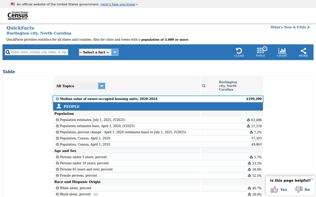
The QuickFacts display is useful for keeping the city’s measured population separate from the postal areas used to sort addresses. It does not provide a population for an individual ZIP.
County records add another layer. Alamance County includes multiple municipalities and unincorporated land, while Graham is the county seat. Some property and election questions therefore begin outside Burlington even when the address uses a Burlington postal area. Keep the postal, city, and county labels separate in notes and requests.
Note: The 2025 population estimate is time-stamped data, so it should not be treated as a permanent measure of any ZIP area.